What You Get
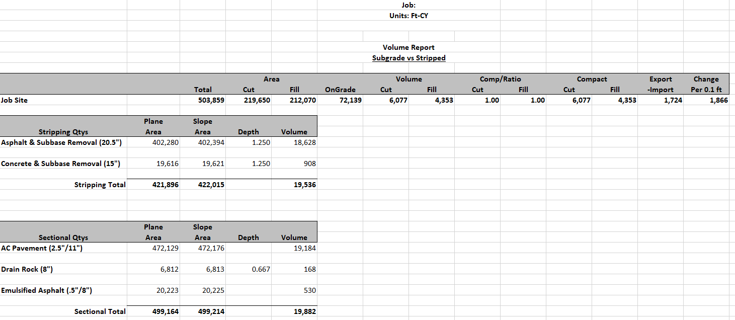
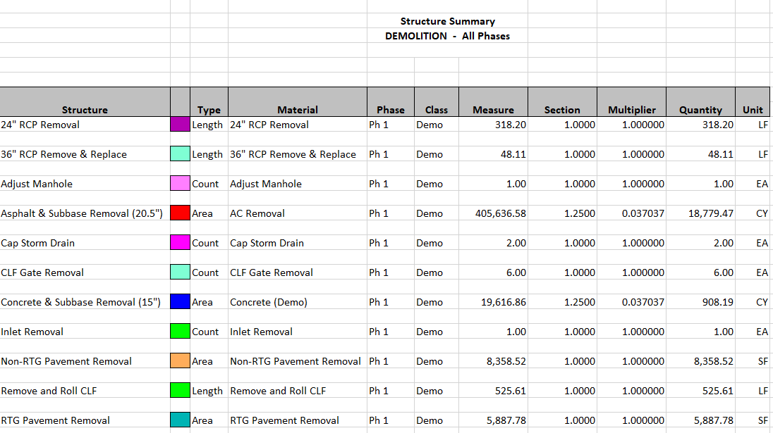
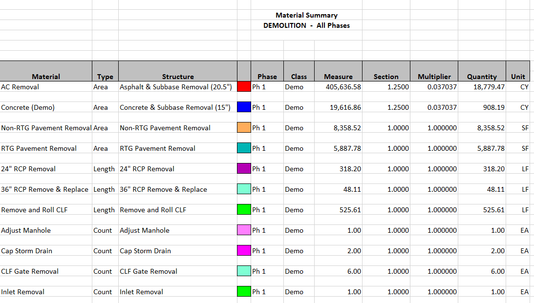
Below are some examples of the information we provide in our package. Each project is unique and we make sure to tailor each job to your specific needs.
The Reports


This is the backbone of what we do. We customize this report to be as detailed or simple as you would like. Within the report are all your areas and volumes. Cut and fills, topsoil strip and replace, stone and asphalt quantities, curb and sidewalk, erosion control items, and much more. We work hard to grant any request for specific information you may need at the initial time of the report and throughout your project.
Google Earth File
This is a very powerful tool. Using the free Google Earth software you can import your job and see all of your demo, cuts and fills, pipe, materials, etc. overlaid on top of Google Earth. You can take this into the field and interact with the data to see specific quantities throughout your entire jobsite.
3D Views
These view are essential in helping you to visualize your project. Our technology gives you the ability to view your project from any angle. View the existing grades, sub-grades, over excavation, or proposed final grades with colors showing you exactly where you need to cut and fill.
Plan Grid View
This view is similar to the 3D view but puts numbers to your cuts and fills. See your entire site or just a portion with contrasting colors showing you how you will need to shape the dirt. These views can be very useful when planning your project stages and haul routes.


