Warning: Undefined array key "background_slider_random_order" in /home/u622737633/domains/earthworkdigital.com/public_html/wp-content/plugins/fusion-builder/inc/helpers/class-fusion-builder-background-slider-helper.php on line 365
How It Works
Earthwork Estimating Services, Start to Finish
Our process is designed for speed, accuracy, and simplicity. Whether you’re bidding on grading, utilities, or full site packages, we make it easy to get the digital takeoff data you need — without slowing down your operation.
In the Office
We Handle the Takeoffs, You Focus on the Business
Let us take the estimating off your plate so you can bid more jobs and run your company more efficiently. Here’s how it works:
Let us take the estimating off your plate so you can bid more jobs and run your company more efficiently. Here’s how it works:


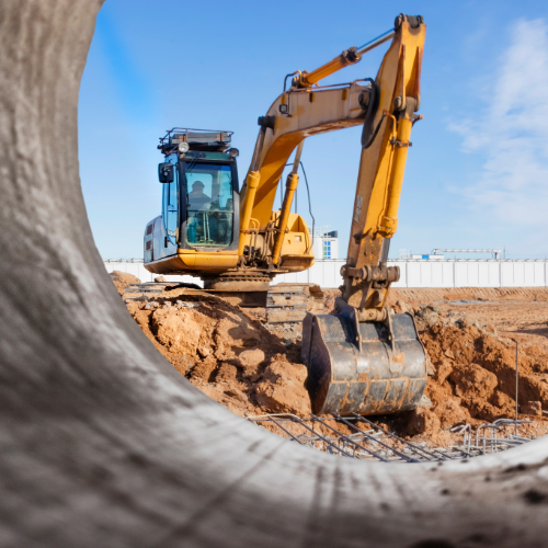
How it works in the field
Takeoff Data That Works Where You Work

You’re not always behind a desk — and neither is our deliverable.
We give you field-ready tools that your team can actually use:
- 📲 Tablet and laptop compatible maps
- 🌍 Google Earth files for real-time visualization on site
- 🖨️ Large-format prints available for overnight shipping
Your foreman, PMs, and operators will have the info they need — where and when they need it. Because sometimes, having the right numbers in your hand is what makes the difference between a winning job and a costly mistake.
What You Get
Every Detail, Delivered
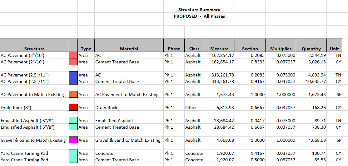
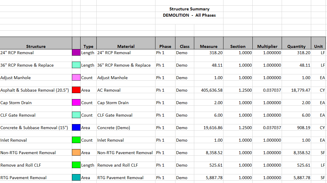
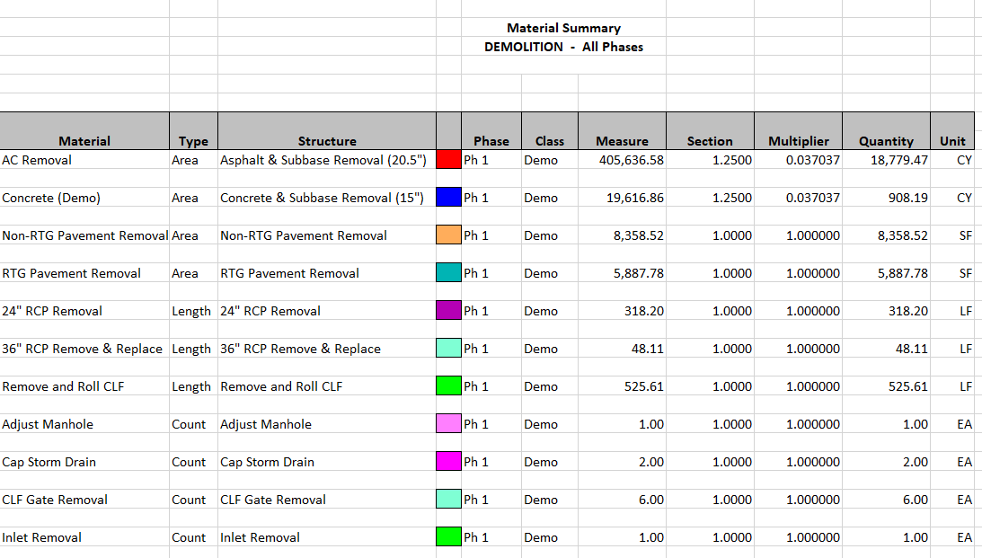
Every job is unique, and we make sure your takeoff package reflects that. Below are some examples of the information we provide in our package.
Every job is unique, and we make sure your takeoff package reflects that. Below are some examples of the information we provide in our package.
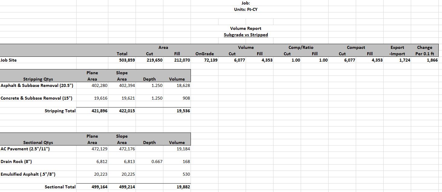
The Reports
This is the core of our service. We customize each report to fit your scope and preferences. You’ll get clear documentation on:
- Cut and fill volumes
- Topsoil strip and replace
- Rock, stone, and asphalt quantities
- Curb, sidewalk, and erosion control
- And more — just tell us what you need
If something’s missing, we’ll add it. If something changes mid-project, we’ll update it.


Google Earth File
This is a very powerful tool. Using the free Google Earth software you can import your job and see all of your demo, cuts and fills, pipe, materials, etc. overlaid on top of Google Earth. You can take this into the field and interact with the data to see specific quantities throughout your entire jobsite.


Passionate – Dedicated – Professional
latest news & insights
Stay up to date with industry trends, earthwork estimating tips, and updates from the field. Our insights help you make informed decisions and stay ahead of the competition.